So the last few days have been a blur of exciting and picture-worthy events, but there hasn't been a lot of deep thought attached. As such this is mostly going to be a string of pictures and brief descriptions.
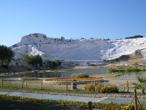
Our journey begins at Pamukkale, a huge tectonic upheaval of calcium bicarbonate, limestone, chalk, etc... basically everything white that can be tectonically upheaved. This is every bit as bizarre-looking as it sounds.
Our journey begins at Pamukkale, a huge tectonic upheaval of calcium bicarbonate, limestone, chalk, etc... basically everything white that can be tectonically upheaved. This is every bit as bizarre-looking as it sounds.
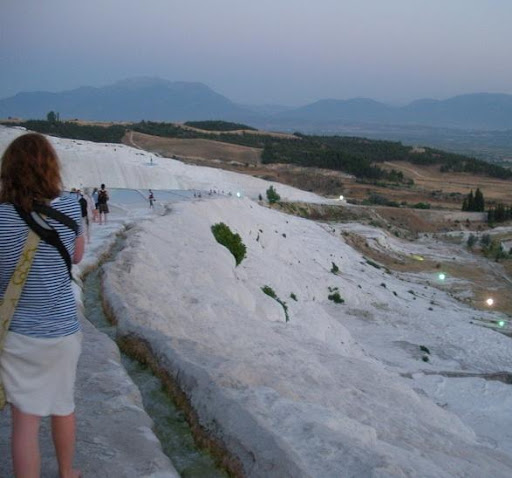
After a long and, you know, bizarre walk up, we reached the site of Hierapolis, the city built around the springs that created Pamukkale itself. The city is in ruins, obviously, but it's still a pretty incredible place.

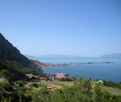
The next day we departed for Eğirdir, a small town on an eponymous lake (or maybe the town is eponymous - I'm unsure) that is apparently a popular resort destination for Turks.
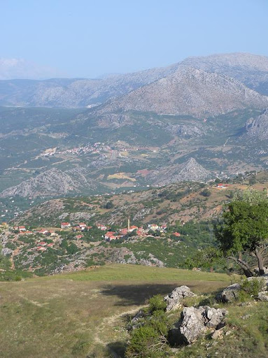
Upon my arrival the mountain climbing urge that had been barely suppressed through this long Philmontless summer awoke with a vengeance and I proceeded to climb Sivri Dağ ('The Sharply Upward Pointed Mountain') while my compatriots swam around in the lake.
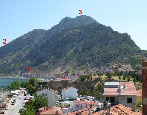
To give some idea of scale, there are 10-story buildings at the foot of the mountain (1). I walked around the back of the mountain (2) before reaching the summit (3) from the back.
Quite delightful.
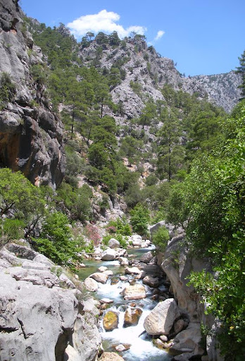
Today we went to a national park about an hour from the town (and lake) of Eğirdir that features a long canyon carved out by a river. We swam in the river. Good times were had by all.
All of these sites occupied different niches in the tourism market. It was possible to gauge the prominence and projected audience for each site based on the languages used at each. Pamukkale, as the international tourism site that it is, featured all the important languages (i.e. Turkish, English, French, German, and, again bizarrely, Korean). The Hieropolis sites were in Turkish, English, and Greek.
Eğirdir, targeted as it was towards a primarily Turkish crowd, had very little in foreign languages. There were, unfortunately, no signs in any language helping the lonely hiker to find his way up Sivri Dağ, but the village halfway up was all in Turkish and the villagers I spoke with lacked the basic knowledge of English that most Turks possess in areas of higher international tourism.
The national park, again, had signs only in Turkish. This seemed passing strange, as the only group there (us) was not, in fact, Turkish.
2 comments:
A beautiful shot of the theatre at Hierapolis! And of the valley from the top of your mountain (hike). Also the shutters on the Sirence house.
Ditto Mom's comments about the Hierapolis photo!
So who is the mythical person? Egirdir?
Ok, make me feel bad, how long was the hike up the Sivri Dag, and how long did it take you? Elevation? Did you use your GPS? Oh, I forgot, you don't believe in those. Then I assume you used the map and compass? Are you now a
dağlara tırmanmak?
Or is this a habbeyi kubbe yapmak, pireyi deve yapmak?
Post a Comment